With World Ocean Day this year focusing on marine protected areas for our blue planet, we consider how Raymarine are bringing marine conservation to the helm, through marine protected areas in Raymarine Lighthouse Charts
Sunday - 07 June 2026
As marine environments face increasing pressure from human activity, the role of technology in supporting sustainable navigation has never been more important. Raymarine’s Lighthouse Charts are evolving beyond traditional navigation tools; now integrating extensive Marine Protected Area (MPA) data to help mariners navigate responsibly while protecting fragile ecosystems.
Raymarine has incorporated a wide range of marine protected area designations directly into Lighthouse Charts, giving boaters clear visibility of ecologically sensitive zones. These include:
By embedding these classifications directly into chart layers, Lighthouse Charts enable captains to make informed routing decisions in real time, minimising environmental impact while maintaining safe and efficient passage.
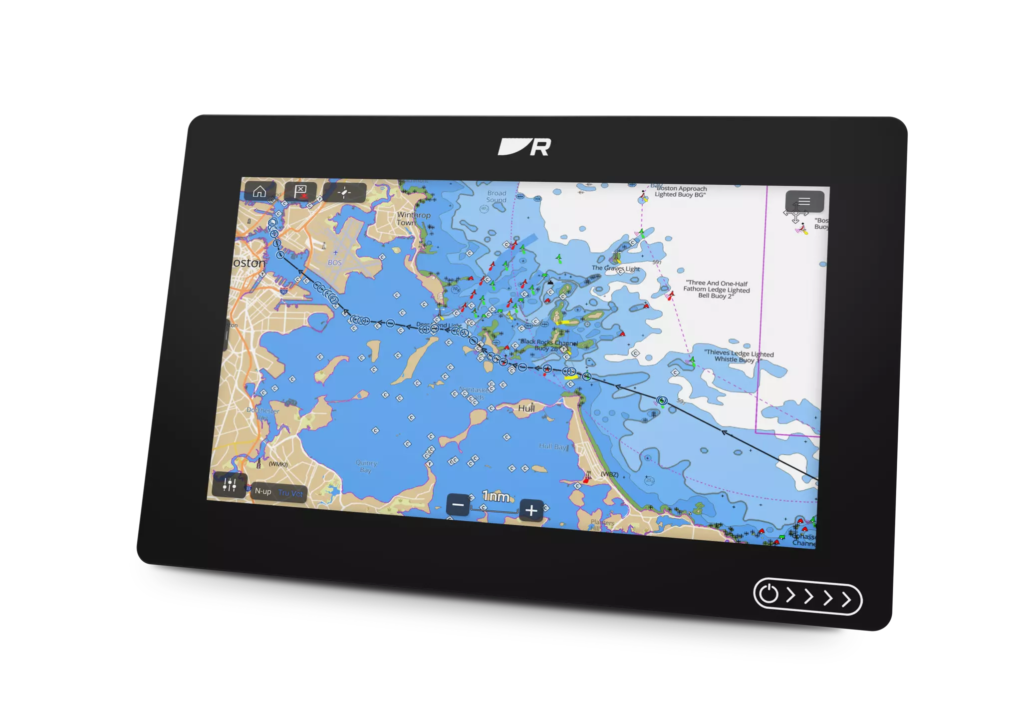
This is not a small overlay. Raymarine has integrated over 45,000 marine protected areas (45,108 in total) across its global Lighthouse Chart portfolio, marking a significant advancement in both chart intelligence and environmental awareness.
Coverage spans virtually every major boating region worldwide, with particularly strong representation in:
By visualising MPAs directly within electronic charts, Raymarine is helping to:
For commercial operators, USV developers, and port authorities, this integration is particularly valuable—helping ensure autonomous or remote operations remain aligned with environmental protections.
This innovation comes at a time of growing global focus on ocean protection. World Ocean Day, held annually on 8 June, highlights the critical role oceans play in sustaining life and mobilises action to protect marine ecosystems. In 2026, the United Nations theme “Reimagine”, alongside the wider action focus on “Strong Marine Protected Areas for Our Blue Planet”, calls for a fundamental shift in how we interact with the ocean and accelerates efforts to protect at least 30% of global waters by 2030.
By integrating marine protected areas directly into Lighthouse Charts, Raymarine is actively supporting this global mission; turning awareness into practical, on-the-water decision-making that helps safeguard biodiversity and preserve ocean health for future generations.
This enhancement reflects a broader shift in marine electronics, from pure navigation tools to intelligent systems that combine safety, performance, and environmental responsibility. With MPAs seamlessly embedded into Lighthouse Charts, Raymarine is empowering mariners to explore with confidence while preserving the waters they depend on.
Whether navigating coastal waters, planning offshore passages, or operating advanced vessels, Lighthouse Charts now provide a clearer picture of not just where you can go, but where you should go carefully.
Explore Without Limits - while protecting what matters most.