NEW! Axiom 2 Chartplotters Now Available
Explore
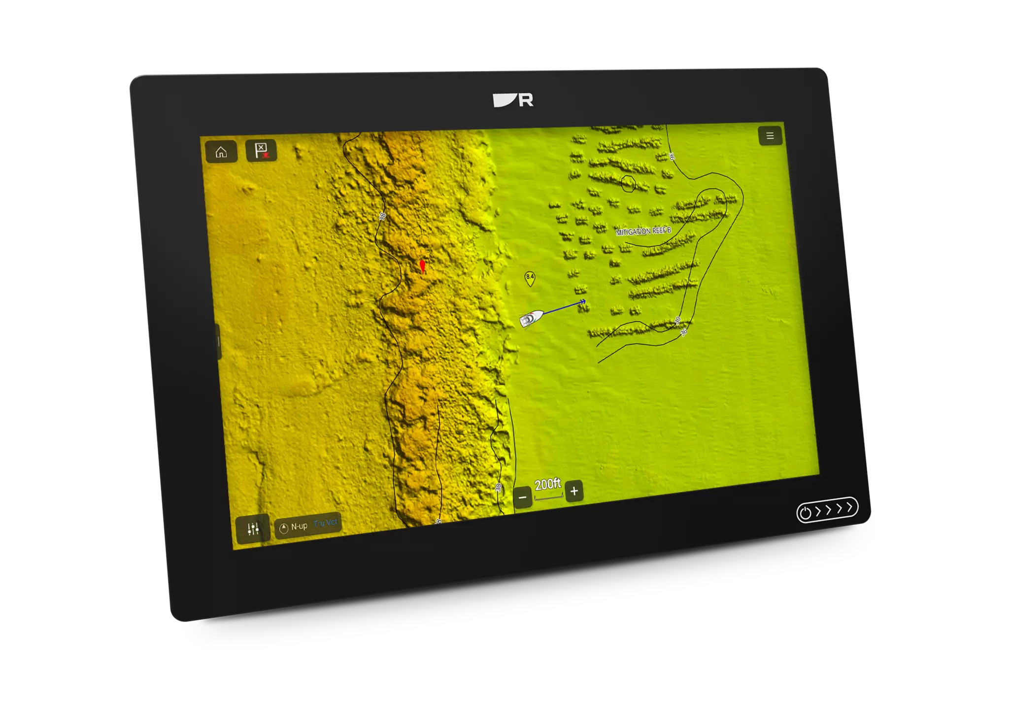
Raymarine announces Axiom chartplotter compatibility with new CMOR NEX GEN high-resolution mapping.
Thursday - 26 March 2026
Hudson, NH: Raymarine – global leader in high-performance marine electronics for the recreational boating, marine first-responder and law-enforcement markets – announced today that the new CMOR NEX GEN all-in-one seafloor and navigational charts are now compatible with all Raymarine Axiom 2 chartplotters. The initial release will be for the South and West Florida regions, with the full 13-region catalog rolled out in the near future.
CMOR NEX GEN transcends traditional mapping by combining ultra-high resolution bathymetric imagery with full navigational data and satellite imagery – so whether fishing, diving or safe-navigating, everything a boater could need is visible at a glance.
Key features available with CMOR NEX GEN mapping on Raymarine Axiom 2 chartplotters (with LightHouse operating software version 4.11 or greater) includes:
“At Raymarine, we understand boaters have a wide variety of favorites when it comes to the 'flavor' of mapping they prefer – whether they're serious anglers, sailors or daytime cruisers,” said Jamie Dery, Vice President of Raymarine Americas. “CMOR NEX GEN is not just simply a map, it offers the complete marine view from deep water to shorelines. This integration is sure to give our customers a new level of confidence while navigating and exploring new locations across the seas.”
Learn more about CMOR Mapping's NEX GEN charts for Raymarine chartplotters.