NEW! Axiom 2 Chartplotters Now Available
Explore
January 2026 - Navigate with confidence using LightHouse Charts. Premium visuals, official data, and seamless Axiom integration. Stay safe with regular updates, new global regions, and easy online chart management.
Tuesday - 13 January 2026
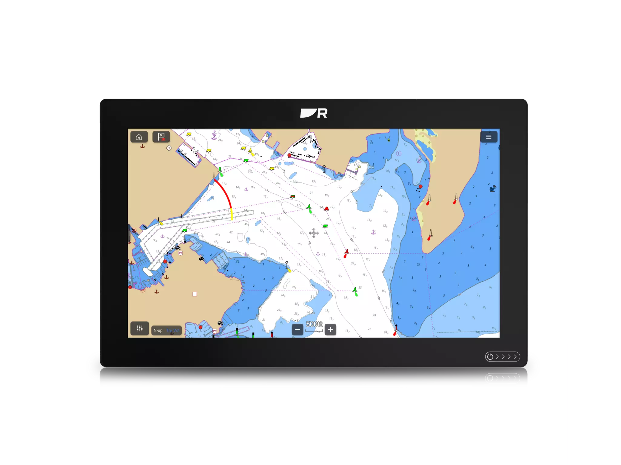
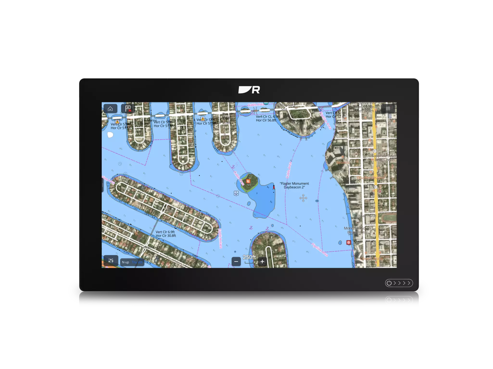
LightHouse Charts by Raymarine offer a premium navigation experience with crisp visuals, customizable layers and seamless integration with Axiom chartplotter displays. Built from official hydrographic sources and enhanced with Raymarine’s clear icons and visualizations, these premium nautical charts simplify route planning and improve situational awareness for safer and more enjoyable boating.
New chart regions are added regularly, and existing titles receive frequent updates to reflect changes in coastlines, hazards and marine infrastructure. Most LightHouse Charts titles include one year of free updates, easily managed through our online Chart Manager.
Boaters in North America, Europe and Australia have long enjoyed the clarity and accuracy of LightHouse Charts in their boating regions. We’ve recently added several new titles in 2025, with even more coming in 2026. Our most recent additions include:
Shortly, we’ll be releasing these titles too. Watch for them on the LightHouse Chart Manager online:
Keeping your charts current is essential for safe and efficient boating. Updated charts help you avoid hazards, comply with regulations and plan smarter routes with the latest data.
LightHouse Charts can be easily updated online using the LightHouse Charts manager. To get started you’ll need a PC or Mac with a SD or microSD card reader and access to the internet. Connect today and get started at: http://chartmanager.raymarine.com.
Updating is quick and easy. Our Getting Started with LightHouse Charts video tutorial has all the information you need to get your charts up to date, today! Watch online here:
https://chartmanager.raymarine.com/how-to-guide.