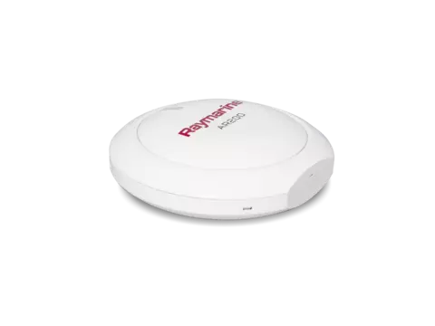
Video stabilization, GPS, and heading sensor for ClearCruise Augmented Reality on Axiom chartplotters


The AR200 is a unique marine sensor and video stabilization module consisting of a GPS (GNSS) receiver and an Attitude and Heading Reference System (AHRS) sensor. The AR200 provides GPS position, compass heading, pitch, and roll data to Axiom chartplotters. Combined with a compatible marine camera, the AR200's video stabilization capabilities enable ClearCruise™ Augmented Reality features available on Axiom chartplotters.

See critical navigation objects overlaid on HD video. Surrounding AIS-equipped vessel traffic and charted navigation aids are clearly identified with rich graphics on a live, dynamic video image.

Color-coded labels provide instant identification, status, and risk-assessment Live AIS Targets. ClearCruise AR provides positive identification of AIS equipped vessels on the horizon.

Major chart objects are identified for instant, heads-up recognition. ClearCruise AR technology shows you visually where your saved waypoints and marks are located.

Visualize nearby marks and waypoints for easy navigation. ClearCruise AR technology makes it easy to pick out the buoys marking the edges of the safe channel on a hazy day.
ClearCruise™ AR (Augmented Reality) brings enhanced on-water awareness to Raymarine’s family of Axiom® chartplotters. With ClearCruise AR, you can make smarter decisions with physical navigation objects overlaid directly on Axiom’s high-definition video display.

$634.99 (USD)
| GNSS (GPS) receiver | |
|---|---|
| Geodetic Datum | WGS-84 |
| Satellite Differential Type (SBAS) | WAAS (United States), EGNOS (Europe), MSAS (Japan), GAGAN (India), QZSS ready (Japan) |
| Channels | Simultaneously track up to 28 satellites |
| Antenna | Internal |
| GNSS (GPS) satellite system compatibility | GPS, GLONASS, Galileo ready, Beidou ready |
| Sensitivity | Cold start = -147 dBm, Re-acquisition = -160 dBm, Tracking = -164 dBm |
| Signal acquisition | Automatic |
| Differential acquisition | Automatic |
| Operating frequency | 1574 MHz to 1605 MHz |
| Update rate | 10 Hz |
| Position accuracy with SBAS (95%) | < 5 m |
| Time to first fix from hot start | < 45 seconds |
| Time to first fix from cold start | < 2 minutes (< 60 seconds typical) |
| Position accuracy without SBAS (95%) | < 15 m |
| Speed accuracy (95%) | < 0.3 kt |
| AHRS | |
|---|---|
| Magnetic compass accuracy | Static = ≤ 1° RMS, Dynamic = ≤ 3° RMS |
| AHRS (Attitude Heading Reference Sensor) | 3-Axis digital accelerometer, 3-Axis digital compass, 3-Axis MEMS Gyro digital angular rate sensor |
| Heading, Pitch, Roll and Rate of Turn update rate | 10 Hz |
| Pitch, Roll and Yaw accuracy | ≤ 1° |
| Environmental | |
|---|---|
| Waterproof rating | IPx6, IPx7 |
| Storage temperature range | -25° C to +70° C (-13° F to 158° F) |
| Operating temperature range | -25 ° C to +55° C (-13° F to 131° F) |
| Relative humidity | 0.93 |
| Conformance | |
|---|---|
| Standards | EMC Directive 2014/30/EU, Australia and New Zealand C-Tick compliance Level 2, RoHS Directive 2011/65/EU, WEEE Directive: 2012/19/EU |
| Physical | |
|---|---|
| Dimensions | Diameter: 108.48 mm (4.27 in), Depth: 41.57 mm (1.64 in) |
| Power | |
|---|---|
| Operating voltage range | 9 V dc to 16 V dc (protected up to 32 V dc) |
| Power consumption | 30 mA Max |
| Nominal supply voltage | 12 V dc (Supplied by the SeaTalkng network) |
| LEN (NMEA 2000 Load Equivalency Number) | 1 |
| 1 | Mounting trim (Top) |
| 2 | Small sealing ring |
| 3 | AR200 |
| 4 | 3 x large bulkhead bracket fixings (Pan head pozi DIN7981 ST 3.9x22 C Z A4 Stainless steel) |
| 5 | Mounting tray (Bottom) |
| 6 | 4 x small surface mount fixings (Pan head pozi DIN7981-ST 2.9x13 C Z A4 Stainless steel) |
| 7 | Bulkhead (Wall) bracket |
| 8 | Large sealing ring |
| 9 | Documentation |
| 10 | 6 m (19.69 ft) SeaTalkng (White) cable |